Distance – 114km
Cols – Col l’Izoard, Col du Var
Additional Routes – Lac de Serre-Poncon (Route 115km), Col d’Allos (el. 2250 m.) – Col des Champs (el. 2087 m.) – Col de la Cayolle (el. 2,326 m) (Route 116km)
Download This Route »
Note: You will be asked to log in or register with RoadTrooper.com to gain access to downloadable .KML (Google Earth), .GDB (Garmin), .GPX (Generic) files.
Detailed Information about Barcelonnette »
Route Grande Alpes photo gallery »
The first part of this stage is a 114km run to Barcelonnette taking in Col d’Izoard (el. 2361 m.) including the strange Casse Deserte atop Izoard and then Col de Vars. The route up Izoard is a nicely surfaced road winding through forest and a couple of small villages to the summit where stunning views north and south await.

Refuge Napoleon, North side of Col l’Izoard
At the top everything changes! On the south side is the mythic Casse Deserte (broken desert), a beautiful, strange, rocky environment, with forbidding and barren scree slopes with protruding pinnacles of weathered rock to which the road clings. Do yourself a favour, pull in and just spend a few minutes and look around to appreciate where you are.

Col d’Izoard + La Casse Deserte (broken desert)
From the bottom of Izoard you can take a left for a ride up La Bonnette on D947 or right on D902 to Guillestre.

Pinnacles of weathered rock lean over the D902
Guillestre is worth a stop to have a walk around the 17th century fort of Mont-Dauphin a UNESCO World Heritage Site before heading up Col du Var.

Bikers belting through Col d’Izoard
Col de Vars, elevation (el. 2108 m.) The first stretch of road leaving Guillestre is a cracking sweeping climb that will warm up your tires and blow off the cobwebs.

Sweeping road out of Guillestre to Col du Var
At the top is a monument explaining a bit of history about this pass since the 1300’s.

D902 along Col du Var
This was often a contested border point between Italy – France – Savoie – etc., and a couple of battles have been fought (way) up here, its hard to imagine how they managed to get army’s, guns, canon and supplies up here before roads, not to forget Hannibal who was called the Great for a bloody good reason!

Summit of Col du Var
Along the Var you will pass a few small villages and ski stations where you can grab a coffee. From the top it’s a 30 kilometre (19 mile) descent to Barcelonnette. This is a beautiful, easy and very enjoyable fast ride with good road and more stunning scenery to feast the eyes all the way to Barcelonnette.
Barcelonnette, a good-sized town with a few hotels in and arround it, a couple of good bars and good value restaurants make it a good stop over for a night. I’ve stayed in Hotel Cheval Blanc in the centre of town, it’s a bit run down as it’s still stuck somewhere in the 1970′s, but its clean, friendly and close to a good bar to service my typically Irish drinking problem, i.e. lack of opportunity ![]() The run to Barcelonnette from Briancon is only 114km if you don’t take a detour to La Bonnette, and assuming you have chosen to stay here you can dump your gear at a hotel and take your choice of two afternoon rides.
The run to Barcelonnette from Briancon is only 114km if you don’t take a detour to La Bonnette, and assuming you have chosen to stay here you can dump your gear at a hotel and take your choice of two afternoon rides.
Ride 1. Barcelonnette, Lac de Serre-Poncon and back

Lac de Serre-Poncon
This is a nice easy run along good fast roads around Lac de Serre-Poncon with a few good sweepers where you can open up your throttle. A good route if your feeling tired and lazy and easy on a pillion, but it wont get your blood running like ride 2.

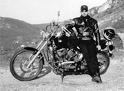
Yours truelly by Lac de Serre-Poncon, worth a run if you have the time.
Ride 2. Barcelonnette to Col du Allos, Col des Champs, Col de la Cayolle
This route is the dogs bollox, I really can’t recommend it enough. Scary, even terrifying and bloody dangerous in places on Col du Allos, the exhilarating and desolate isolation of Col des Champs, and a stunning ride through Col de la Cayolle.

No room for error on Col d'Allos
This may well be the highlight of the whole trip, 114km of adrenalin fulled fun. Col du Allos is a very narrow road clinging to the side of a cliff for a large part, with, as of last May parts of it crumbling into an abyss. Going up is fine, but if you’re coming down towards Barcelonnette and you meet an SUV like I did forcing me to pass inches from the edge and a long long fall to a very messy death then God help you!!!!! This road was not built with a fat, heavy RT in mind.

Refuge on summit of Col d'Allos
Also at one point I had to stop the bike and clear a small avalanche that had dumped snow and rocks over the road. This can easily happen in late May and early June when the snow ploughs have just opened up the roads and the sun starts melting the snow built up to as much as 3 meters at either side of the roads.

Col d'Allos, better road on south side
Col de Champs starts outside Colmar (another fortified town and worth a look) and is a wonderful ride through rugged high alpine scenery and jagged peaks, some parts of the road can be a little dodgy, especially along deep paved drainage ditches, also common here is gravel spilling off the mountains so you really need to watch the road on corners.

First bridge on Col de la Cayolle
This connecting road/pass leads to the village of St. Martin where you can join the D902 back to Barcelonnette via Col de la Cayolle which is a right little beauty.

Col de la Cayolle feels very remote
Again unfortunately you probably wont be getting above 4th gear as much of this road clings to cliffs above a gorge, but it’s a visual treat you wont forget.

Nearing the summit of Col de la Cayolle
The road along Col de la Cayolle can be a little rough and extremely narrow in places but it’s definitely not to be missed with jaw dropping views from bridges spanning the gorge.

Col de la Cayolle summit, despite the snow it's actually really warm!
At this stage you will probably begin to realise all these high passes are stunning, but each one is so different, with every one of them throwing something different at you in such a relatively short distance that it seems you have traversed a continent, the memories will take months to process, this is what makes Route des Grande Alpes so unique in Europe for a motorbike trip. And it’s not over yet, in the next stage the landscape changes drastically from the highest road of La Bonnette to the red rock of Gorge du Daluis, and the epic Gorge de Verdon, oh hell yes!
Videos
Route Instructions
Biker friendly hotels along Stage 5 of the route;
Auberge L’Echauguette – Mont Dauphin Fort
Hotel Restaurant Le Catinat Fleuri – Guillestre
Le Grand Hôtel – Barcelonnette
L’Hôtel du Cheval Blanc – Barcelonnette
Download This Route »
Note: You will be asked to log in or register with RoadTrooper.com to gain access to downloadable .KML (Google Earth), .GDB (Garmin), .GPX (Generic) files.
Road conditions – check the status of the Cols/Passes:
InfoTrafic: Alpes Du Nord
Bison Fute
Next Stage 6 – Barcelonnette to Castellane »